Bomb Cyclones
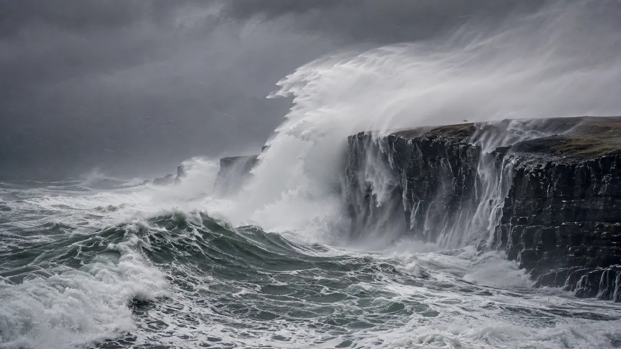
A bomb cyclone is a midlatitude cyclone whose central pressure drops by at least 24 millibars – or hectopascals (hPa), the same unit – in 24 hours, measured at 60° latitude. That rate of pressure decline, not the storm's eventual size or wind speed, is what defines it. The process is called bombogenesis, and the bomb cyclone meaning is entirely about how fast the storm intensifies.
What Does Bomb Cyclone Mean?
At 60° latitude, bombogenesis requires a pressure drop of at least 24 hPa in 24 hours. At the latitude of New York City – roughly 40°N – the threshold adjusts to approximately 17.8 hPa in 24 hours, according to NOAA. The adjustment uses a latitude weighting formula developed in a 1980 paper by MIT meteorologists Frederick Sanders and John Gyakum, who built on earlier work by Swedish researcher Tor Bergeron. Sanders coined the term "bomb" because of the explosive character of these storms.
What is bomb cyclone in structural terms: a standard midlatitude cyclone with a low-pressure centre drawing winds inward at the surface. What sets it apart is speed. Sanders and Gyakum described these as "predominantly maritime, cold-season events." NOAA's explanation of bombogenesis confirms the latitude-adjusted pressure threshold as the sole defining criterion.
How a Bomb Cyclone Storm Develops
Three ingredients must converge: a sharp air mass contrast, an ocean heat source and a favourable jet stream configuration. Remove any one and rapid deepening stalls.
Falling Pressure and Strengthening Winds
Pressure and wind are coupled through geostrophic balance – steeper pressure gradient means faster wind. In January 2018, Winter Storm Grayson reached a minimum pressure of 949 hPa off the New England coast. Winds gusted to hurricane force at 76 mph on Nantucket Island. Boston recorded at least 17 inches of snow. The storm tide reached 4.62 metres in Boston – a new historical record – flooding the Financial District, including a subway station. The highest gusts anywhere reached 126 mph in Saint-Joseph-du-Moine, Nova Scotia. That single storm qualified simultaneously as a bomb cyclone, a nor'easter and a blizzard.
The Role of Air Masses, Ocean Heat and the Jet Stream
Cold continental air meeting warm maritime air over the ocean creates the sharp temperature gradient that drives rapid deepening. The Gulf Stream along the US East Coast and the Kuroshio Current near Japan supply the heat and moisture that fuel intensification once the process begins.
According to the American Meteorological Society Glossary, bomb cyclones typically develop approximately 750 km downstream from a mobile 500-hPa trough, within or poleward of the maximum westerlies. The jet stream's position determines whether an ordinary cyclone has access to the upper-level support needed to deepen quickly. Sanders and Gyakum characterised bombs as predominantly maritime, cold-season events. Most form over open ocean rather than land – the surface heat flux from the water below sustains the system through its deepening phase.
Where and When Bomb Cyclones Are Most Likely
The northwestern Atlantic and northwestern Pacific are the two most active zones. Bomb cyclones are most common along the western sides of oceans, such as the northwestern Atlantic near the east coast of North America and the northwestern Pacific near the east coast of Asia. A study published in 2021 reported that 18 bomb cyclones develop per year over North America and its adjacent seas on average.
Along the US East Coast, the peak season runs October through March. Nor'easters frequently undergo bombogenesis once they move offshore and tap into Gulf Stream heat. The Southern Hemisphere sees its own bomb cyclones over the South Atlantic and Southern Ocean, following the same ocean–jet stream dynamics as the Northern Hemisphere events but peaking during austral winter.
Track developing storm systems and pressure trends for your area on MeteoFlow.
Is a Bomb Cyclone Dangerous?

It depends on where it tracks, what air mass surrounds it and whether it develops over water or land. The definition says nothing about hazard severity – a storm qualifies as a bomb cyclone by pressure rate alone.
Strong Winds, Heavy Precipitation and Coastal Flooding
The January 2018 storm showed what a bomb cyclone winter storm produces when cold air and rapid deepening combine at the coast. Winds gusted to 76 mph on Nantucket; the Boston storm tide of 4.62 metres flooded the Financial District and submerged a subway station – a new historical record. Snowfall rates reached 3 inches per hour in the heaviest bands over New England. The storm caused $1.1 billion in damage and 22 fatalities.
A bomb cyclone developing over the open ocean in autumn, before cold air masses are established, produces something different: gale-force winds, heavy rain and coastal flooding without any snow. The same pressure criterion; entirely different hazard profile.
Why the Hazards Differ Between Storms
Sanders and Gyakum noted in their 1980 paper that bombs "often have hurricane-like features in the wind and cloud fields." That resemblance stops at the definition – a bomb cyclone is an extratropical system, while a hurricane is tropical in origin, and the two are classified separately.
What the hazard actually depends on: the temperature at precipitation level determines rain or snow; the storm's track determines coastal flooding exposure; the distance from the centre determines local wind speed; and whether peak intensity coincides with high tide can double the flooding impact. The January 2018 event combined all four factors unfavourably along the New England coast simultaneously.
Bomb Cyclone vs Winter Storm, Blizzard and Hurricane
One storm can satisfy more than one definition. Winter Storm Grayson in January 2018 was a bomb cyclone by pressure rate, a nor'easter by track and origin, and a blizzard by surface conditions across New England – all at the same time.
| Term | Defined by | Snow required? | Classification basis |
|---|---|---|---|
| Bomb cyclone | Pressure drop ≥24 hPa/24h at 60°N, latitude-adjusted | No | Rate of intensification only |
| Winter storm | Hazardous winter precipitation forecast | Yes or ice | Predicted weather conditions |
| Blizzard | Winds ≥35 mph, visibility <¼ mile, sustained ≥3 hours | Yes | Wind + visibility + snow simultaneously |
| Hurricane | Sustained winds ≥74 mph, tropical origin | No | Wind speed and tropical origin |
A bomb cyclone over warm autumn ocean water produces none of the conditions in the blizzard or winter storm row. A hurricane cannot become a bomb cyclone – it originates from a different atmospheric mechanism and is measured differently. The four terms describe four separate classification systems that occasionally apply to the same event.
Check local forecasts and official warnings on MeteoFlow when bomb cyclone conditions are expected near your location.
FAQ
Who introduced the term "bomb cyclone"?
Frederick Sanders coined "bomb" in a 1980 paper co-authored with John Gyakum in Monthly Weather Review. Both built on Tor Bergeron's earlier threshold for rapidly deepening storms. Sanders later explained he chose the term because these cyclones developed with explosive speed that forecasters found difficult to anticipate.
Can meteorologists predict bombogenesis before it begins?
Numerical weather prediction models can identify the air mass contrasts, jet stream positioning and ocean heat flux conditions that favour rapid deepening 24-48 hours ahead. Precision increases significantly within the final 12-24 hours once the storm has begun developing and model initialisation benefits from more recent observations.
Does a bomb cyclone receive an official storm name?
No national meteorological agency assigns official names to bomb cyclones as a category. Private services sometimes name individual storms informally – the January 2018 event was called Winter Storm Grayson by one broadcaster. NOAA and the National Weather Service issue warnings by hazard type rather than storm name for extratropical systems.
Could climate change affect bomb cyclone activity?
Research produces mixed results. Warming oceans increase the moisture and heat flux available to developing systems, which could intensify individual events. Changes to the jet stream's position and the temperature contrast between air masses – both key drivers of bombogenesis – introduce uncertainty that current projections have not resolved.


