What Are Chinook Winds? Meaning, Locations and Effects
On 10 January 1962, the temperature in Pincher Creek, Alberta climbed 41°C in one hour. That single event captures what a Chinook wind actually is – not a gentle warming trend but a downslope mechanism capable of erasing winter within minutes. The Chinook wind definition is grounded in adiabatic physics: Pacific air crosses the Continental Divide, loses moisture on the way up, and arrives on the eastern prairies compressed and dry. What are Chinook winds at their extreme: gusts that blow over transport trucks, snowpack that vanishes in a day, and temperature swings that dwarf anything a seasonal forecast would predict.
How Air Warms as It Crosses the Rocky Mountains
Rising air cools; descending air warms. The Chinook effect is built on the difference between those two rates and what happens to moisture along the way.
Rising Air, Cooling and Moisture Loss
Unsaturated air cools at roughly 10°C per 1,000 metres as it rises – the dry adiabatic lapse rate. Condensation changes that: once moisture begins forming cloud and precipitation, latent heat released during the process partially offsets the cooling, dropping the rate to around 6°C per 1,000 metres. Rain or snow falls on the windward slopes.
The Continental Divide averages 3,000 to 4,000 metres. Pacific air crossing that elevation sheds a significant portion of its moisture before it reaches the summit. The air that tips over the ridge onto the eastern side is a different parcel from the one that left the Pacific coast – drier, and about to get much warmer.
Descending Air and Compression on the Leeward Side
Dry air descending the eastern slopes warms at the full dry adiabatic rate: 10°C per 1,000 metres. Because it lost moisture – and the latent heat that went with it – on the windward side, it arrives on the plains warmer than it started at equivalent altitude. The Continental Divide's height alone can drive 15-25°C of warming between the summit and the prairie below.
On 15 January 1972, a Chinook in Loma, Montana produced the greatest recorded 24-hour temperature change in US history: from -48°C to +9°C – a 57°C swing, confirmed by the US National Weather Service. The air that produced that reading had crossed the Rockies and compressed all the way down to prairie elevation.
| Side | Temperature | Humidity | Cloud cover | Precipitation |
|---|---|---|---|---|
| Windward (west) | Cooling with altitude | High; condensation likely | Clouds form | Rain or snow possible |
| Leeward (east) | Warming as air descends | Low; air dries rapidly | Clears quickly | Rare or absent |
Where Do Chinook Winds Occur?
Where do chinook winds occur is a question answered by two countries. Chinook winds develop in both Canada and the United States along the eastern slopes of the Rocky Mountains – the answer to which country is both, with southern Alberta and the US Northern Rockies holding the most active zones.
Chinook Winds in Canada
Pincher Creek, Alberta, holds Canada's national record for the largest temperature change in a single day: on 10 January 1962, the temperature climbed 41°C – from -19°C to 22°C – in one hour. The Pincher Creek and Crowsnest Pass corridor through to Lethbridge averages approximately 35 Chinook days per year. Lethbridge ranks second in Canada for days with strong winds; Calgary is the windiest larger city in the country.
The temperature boundary between Chinook and Arctic air can be sharp enough to measure across 45 nautical miles near Lethbridge: 10°C on the Chinook side, -20°C on the Arctic side simultaneously. Gusts exceeding 65 knots have been recorded at that interface in southwestern Alberta.
Chinook Winds in the United States
Loma, Montana: -48°C to +9°C on 15 January 1972 – 57°C in 24 hours, the largest recorded temperature change in US history according to the National Weather Service. Cut Bank, Montana sits at the other end of the spectrum – frequently the coldest spot in the US when Arctic air sweeps south along the Rocky Mountain front. A Chinook can reverse Cut Bank's temperature within hours of that cold arriving.
Colorado's Front Range sees Chinook warming through most winters. Denver and Boulder both experience the rapid warming and drying that follows a strong Pacific air crossing. Wyoming and South Dakota's Black Hills sit within the Chinook zone but see fewer events than southern Alberta and the Montana front.
Track Chinook wind forecasts and temperature changes for your area on MeteoFlow.
How Chinook Weather Changes Winter Conditions

Chinook weather arrives as three simultaneous processes: temperature climbs, humidity drops and snow disappears – sometimes faster than rain could remove it.
Rapid Warming, Lower Humidity and Disappearing Snow
The 41°C rise at Pincher Creek in 1962 remains Canada's benchmark, but the 1992 Claresholm, Alberta event illustrates a different extreme: temperatures reached approximately 24°C in February – one of the highest February readings ever recorded in Canada. In the Lethbridge area, 35 days per winter season exceed 4.4°C due to Chinook events – the meteorological threshold used to count Chinook days in that region.
Snow responds to Chinook conditions through two mechanisms simultaneously. Some melts; some sublimates – converting directly from ice to vapour without passing through liquid. A strong Chinook can remove 30 cm of snow in a single day through this combination. Melt rates reach approximately 2.5 cm of ice per hour. In the Taber agricultural region south of Lethbridge, Chinook frequency is high enough that spring snowmelt rarely occurs – the snow disappears during winter events instead, requiring extensive irrigation to compensate.
Chinook Arches and Other Visible Weather Signs
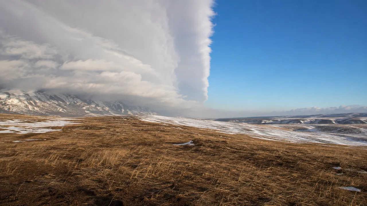
A Chinook arch is a stationary stratus cloud formation that sits over the mountain ridge while clear skies spread across the plains below. It forms as air ripples over the summit and appears from the prairie as a dark wall advancing from the west – but it doesn't advance. The cloud deck marks the boundary between the descending warm air and the retreating cold air below.
That boundary can also appear as a vertical wall of cloud and fog where Chinook air overrides or undercuts denser Arctic air. On one side: clear sky, 10°C, westerly gusts. On the other: overcast, -20°C, still. A strong southwesterly wind arriving before any temperature change is a reliable early signal that a Chinook is developing upstream.
Can a Chinook Storm Be Dangerous?
Chinook storm is an informal expression – no meteorological agency classifies it as an official storm category. The hazards are real regardless of the label.
Wind gusts during Chinook events reach over 100 km/h routinely in southwestern Alberta; the recorded extreme is 106 mph – equivalent to a Category 2 hurricane. Gusts at the Chinook–Arctic air interface near Lethbridge have exceeded 65 knots. Wind turbines in southern Alberta occasionally shut down because the speeds exceed operational limits. Trucks have been blown over on exposed prairie highways.
Rapid snowmelt generates flash flood risk. The 1962 Pincher Creek event strained local water systems as 41°C of warming converted snowpack to runoff within hours. The same warming that clears roads can saturate drainage systems and push rivers above their banks. Agricultural effects include soil drying so rapid that irrigation becomes necessary within days of a Chinook, and plants breaking dormancy during warm spells – leaving them exposed when Arctic air returns.
Chinook Winds and Other Foehn Winds
The name comes from the Chinook people of the Pacific Northwest, whose territory near the Columbia River sits in the source region of the moist Pacific air that eventually crosses the Rockies. The Blackfoot name for the same wind is Asi'kssopo – "warm wind" – and indigenous oral tradition recorded dramatic warming events long before European contact.
The same physics produces named winds on every major mountain range. The Foehn runs down the Alps into Germany, Switzerland and Austria. The Zonda descends the Argentine Andes. The Berg wind blows off South Africa's escarpment. All share the adiabatic mechanism: moisture loss on the windward side, dry compression on the leeward side, warmer air arriving on the plains below than left the upwind coast.
Check local temperature forecasts and official wind warnings on MeteoFlow before travel or outdoor activities in Chinook-prone regions.
FAQ
Can Chinook winds occur outside winter?
Yes. Adiabatic descent happens year-round. Winter events stand out because they flip sub-zero temperatures into mild ones within an hour. The same process in July produces a dry, warm afternoon; the baseline isn't cold enough for the contrast to register as dramatic.
How long can a Chinook wind event last?
Hours to several days. A short event warms rapidly then retreats as Arctic air returns. Lethbridge averages 35 winter days above 4.4°C due to Chinook events – that total spreads across dozens of individual episodes of varying length through the season.
Can Chinook winds develop without rain or snow over the mountains?
Yes. Windward precipitation maximises the warming because the air releases latent heat going up and then gains the full dry adiabatic rate coming down. A dry foehn – air descending without prior moistening – still warms through compression alone, just from a lower starting advantage.
How are Chinook winds forecast?
Upper-level pressure patterns, jet stream position and the Pacific-to-continental temperature contrast are the primary inputs. Environment Canada and the US National Weather Service issue downslope wind advisories when conditions favour strong events. A Chinook arch sitting stationary over the ridge is the visual signal that the process is already underway.


