How Are Tornadoes Formed and What Causes Them?
Tornadoes form inside severe thunderstorms when warm moist air and cold dry air collide under the right atmospheric conditions. That collision alone is not enough – what causes tornadoes is the combination of that instability with wind shear, which introduces rotation into the storm.
How are tornadoes formed comes down to a sequence: unstable air builds a powerful storm, wind shear creates spinning motion, and a strong updraft tilts that motion vertical. When conditions align, a rotating column of air can extend from the storm base to the ground in under a minute.
Weather Conditions That Lead to Tornado Formation
Tornadoes do not form randomly. Specific atmospheric ingredients must be present simultaneously, and tornado formation becomes most likely where those ingredients combine most reliably.
Warm Moist Air and Cold Dry Air
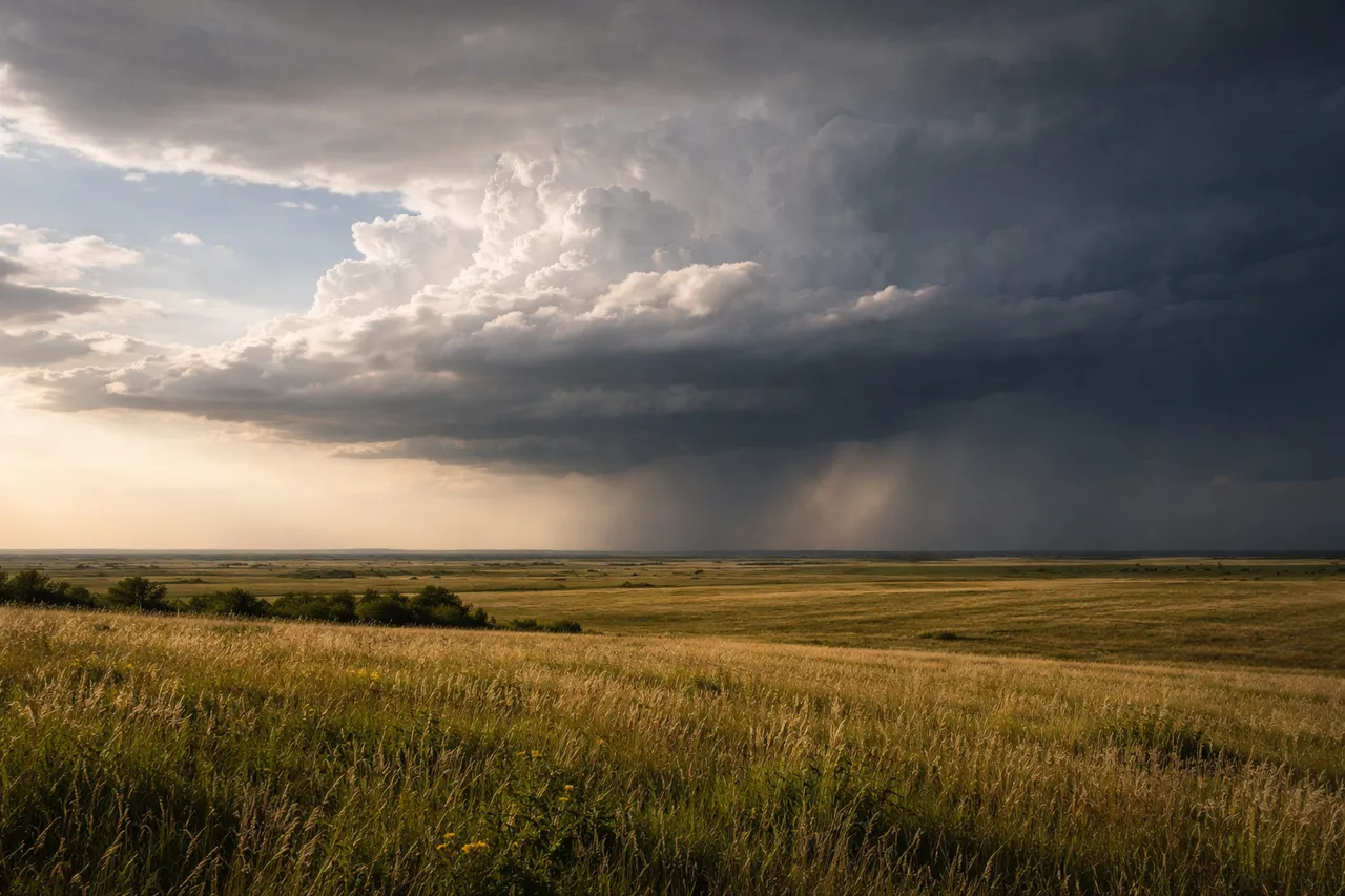
The Gulf of Mexico feeds warm, humid air northward across the central United States. From the west, cold dry air descends from the Rocky Mountains and moves eastward across the plains. Where these two air masses meet, the temperature contrast can exceed 20°C across a distance of just a few hundred kilometers.
That gradient is not gradual. The boundary between the air masses is sharp, and the atmosphere responds to it violently. The warm air wants to rise rapidly; the cold air resists. The tension between them is the energy source that drives severe storm development.
Atmospheric Instability in Severe Storms
When warm air rises into a cooler environment and keeps accelerating rather than stabilizing, the atmosphere is considered unstable. Meteorologists measure this with CAPE – Convective Available Potential Energy. Values above 2,500 J/kg indicate high instability capable of supporting severe storms.
During major tornado outbreaks across the US Great Plains, CAPE values have exceeded 5,000 J/kg. At those levels, storm updrafts accelerate with enough force to sustain the rotation and organization that tornado-producing supercells require.
The Role of Wind Shear in Tornado Formation
Instability provides the energy. Wind shear provides the rotation. Understanding how do tornadoes form requires both – a highly unstable atmosphere without wind shear produces severe storms, but rarely tornadoes.
How Horizontal Rotation Develops
Wind shear means wind speed and direction change with altitude. At the surface, winds may blow from the south. A few kilometers up, they shift to the west and increase in speed. That difference in direction and velocity across altitude creates a horizontal tube of rotating air in the lower atmosphere.
A wind shift from southerly at the surface to westerly at higher altitude – a pattern common ahead of approaching cold fronts – generates this horizontal rotation across a layer several kilometers long. The air is already spinning before any thunderstorm develops above it.
How Updrafts Turn Rotation Vertical
A strong thunderstorm updraft intersects that horizontal rotation tube and tilts it. One end of the rotating tube gets pulled upward while the other stays near the surface. The spinning axis shifts from horizontal to vertical inside the storm.
Updraft speeds in a supercell thunderstorm can exceed 160 km/h – fast enough to carry large hailstones upward repeatedly before they fall. That same force is what tilts the rotation axis and begins organizing the vertical spin that tornado formation depends on.
How a Tornado Starts Inside a Thunderstorm
Once vertical rotation is established inside a supercell, the storm enters a phase where how does a tornado start becomes a question of organization and intensification rather than initial formation.
From Supercell Storm to Funnel Cloud
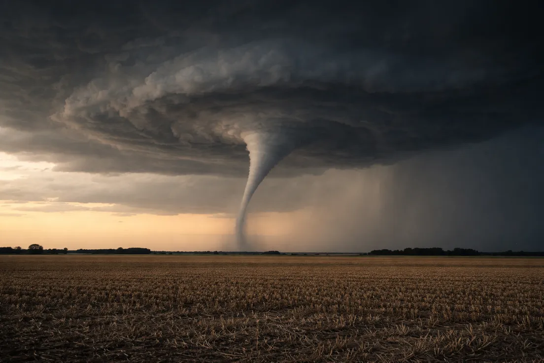
Vertical rotation inside the storm organizes into a mesocyclone – a column of rotating air that can span 3 to 10 kilometers in diameter. That is far wider than any tornado it eventually produces. The visible funnel represents only the core of the rotation, not its full extent.
Beneath the storm base, a wall cloud forms – a lowering of the cloud base where rotation is strongest and pressure is dropping. As pressure at the rotation center falls further, air cools and condenses into a visible funnel that extends downward from the wall cloud toward the surface.
When the Tornado Touches the Ground
A funnel cloud becomes a tornado only at the moment of ground contact. That transition can happen in under a minute. The rotating wind at the surface may already be damaging before the visible condensation funnel has fully descended – the funnel marks where pressure is low enough for moisture to condense, not where the wind begins.
At ground contact, the inflow of surface air into the base of the tornado accelerates. Wind speeds at the contact point can increase rapidly in the first minutes after touchdown, making the earliest stage of a tornado's ground track one of the most intense.
Check severe storm forecasts and radar conditions on MeteoFlow when tornado risk is mentioned in your region.
Why Some Tornadoes Become More Powerful
Not every tornado that touches the ground intensifies. The formation of a tornado is only the beginning – what happens in the minutes after ground contact depends on whether the storm can sustain and concentrate its rotation.
A continuous supply of warm moist air feeding into the storm's inflow keeps the updraft strong. A well-organized supercell with strong wind shear allows the mesocyclone to tighten around a narrowing core. As the rotation contracts, wind speed increases – the same principle that causes a spinning figure skater to accelerate when pulling their arms inward. The physics are identical: conservation of angular momentum in a shrinking radius.
Tornadoes that track across flat, open terrain maintain their energy supply longer than those that encounter hills, forests, or urban areas. Unobstructed inflow keeps the updraft fed. Smooth terrain offers no friction to disrupt the low-level circulation. The combination of sustained inflow, strong shear, and open ground is what separates a brief weak tornado from one that stays on the ground for tens of kilometers.
What Causes a Tornado to Weaken and End
Most tornadoes last less than ten minutes. The same storm dynamics that produce them also carry the conditions that end them.
Cold air wraps around the back of the mesocyclone as the storm matures. That cold air intrusion cuts into the warm inflow feeding the tornado from the surface. Without a continuous supply of warm moist air, the updraft weakens. Rotation slows as the energy source diminishes.
As the inflow is cut off, the tornado stretches. The base lifts, the column narrows, and the tornado enters what meteorologists call the rope-out stage – a thin, elongated column that twists and contorts before dissipating entirely. The rope-out stage can produce the most erratic and unpredictable movement of the entire event. A tornado that has been tracking in a straight line may begin looping or reversing direction as it loses organization.
Once the connection between the surface circulation and the storm's updraft breaks, the tornado dissipates. The parent storm may continue and produce another tornado minutes later if conditions reorganize – long-track tornado events often involve multiple cycles of the same supercell rather than a single continuous vortex.
Use MeteoFlow to follow storm forecasts and track changing weather conditions when severe weather is developing in your area.
FAQ
Why do tornadoes form more often in some regions than others?
Geography determines ingredient availability. The US Great Plains sit where Gulf moisture, Rocky Mountain cold air, and strong wind shear overlap most reliably. How are tornadoes formed anywhere depends on the same ingredients – the Plains just supply them together most often.
Can tornadoes form without a supercell thunderstorm?
Yes. Waterspouts and landspouts form through weaker rotation mechanisms that do not require a supercell. They follow similar basic physics but produce less intense winds and shorter ground tracks than supercell tornadoes.
What is the difference between a funnel cloud and a tornado?
A funnel cloud is rotating air descending from a storm base that has not reached the ground. A tornado requires ground contact. The damaging wind may already be present at the surface before the visible funnel fully descends.
How fast can tornadoes develop?
Ground contact can occur in under a minute once a funnel cloud begins descending. A supercell may take 30 to 60 minutes to organize before producing one – but the final transition from funnel to tornado is rapid.
What conditions make tornadoes more dangerous?
High wind speeds, large diameter, slow forward movement, and nighttime occurrence. Tornadoes that move slowly cause prolonged damage along a narrow track. Those that form at night reduce warning time because they are harder to see and many people are asleep.