How Different Can the Weather Be Within the Same Region?
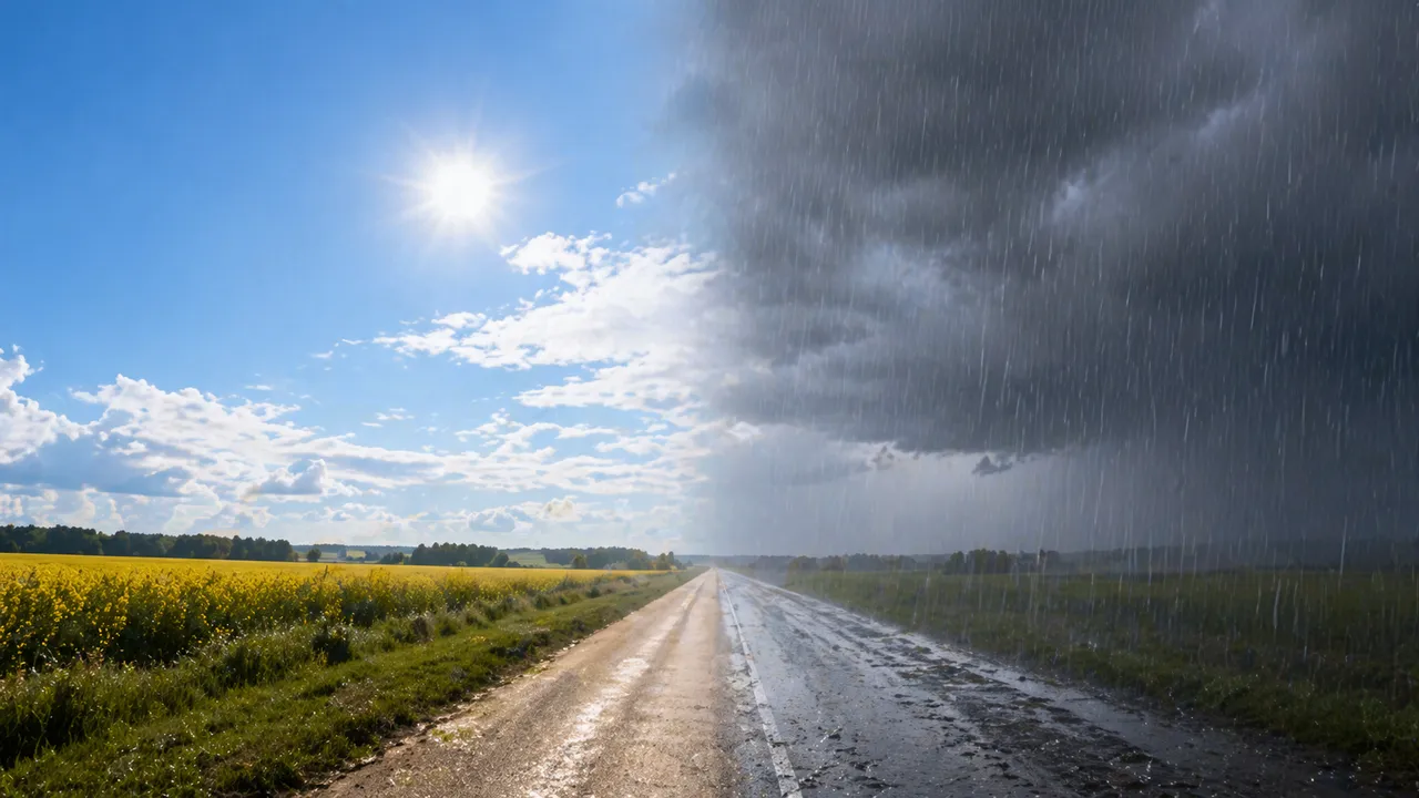
The forecast showed sunshine. Outside, the sky was grey and the air was cold – while a friend five miles away was sitting in clear light. This is not a forecast error. It is the result of how local geography shapes atmospheric conditions at ground level. Weather variability within the same region is normal, measurable, and largely predictable once you understand what drives it. Local weather differences of several degrees over short distances happen every day.
Why Weather Varies So Much Over Short Distances
Weather is not a uniform layer spread evenly across a region. Terrain, water, vegetation, and urban surfaces all interact with the atmosphere differently, creating pockets of distinct conditions within the same general area.
Why is the weather different in nearby areas? It comes down to local geography overriding regional patterns. A city forecast reflects conditions at one measurement point – usually a city centre station. Everything outside that point – a hillside, a valley floor, a coastal strip – responds to the same regional weather system differently.
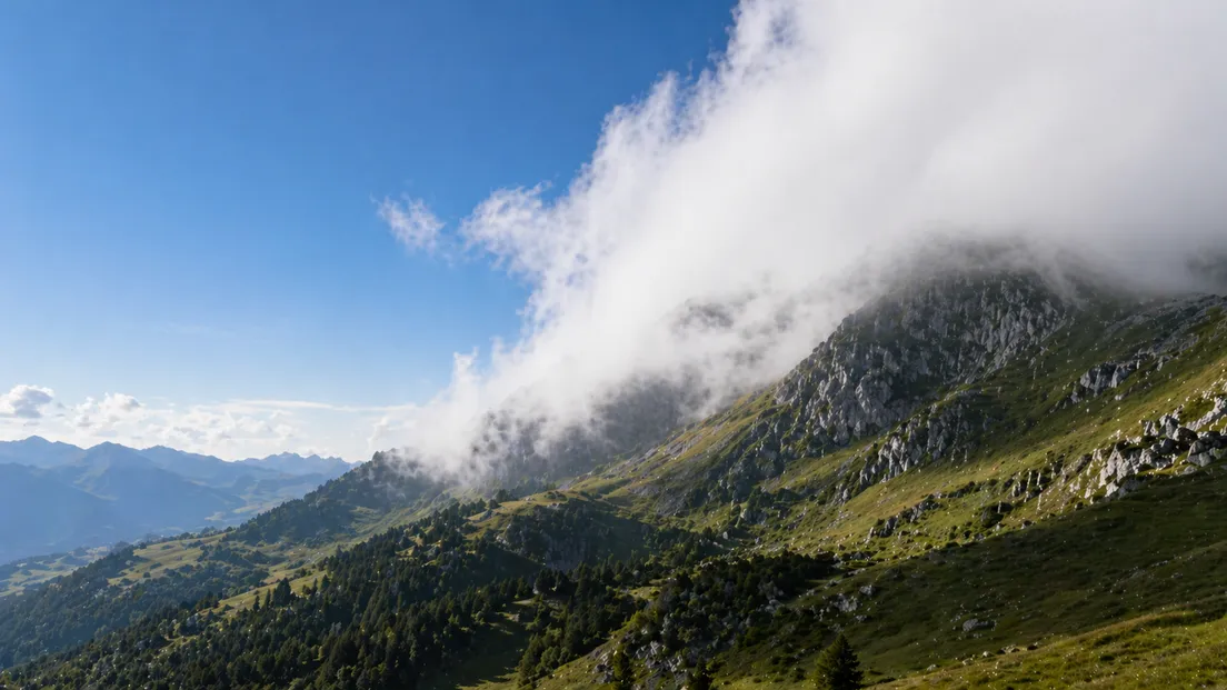
Altitude: Why Higher Ground Means Different Weather
Temperature drops by approximately 1°C for every 100 metres of altitude gained. A hill 400 metres above the valley floor will be around 4°C colder than the ground below it – even if both are under the same weather system.
That difference is enough to determine whether rain falls as rain or snow, whether fog persists through the morning, or whether frost forms overnight. A valley in sunshine and a hilltop in low cloud can sit within a few kilometers of each other and experience conditions that feel like different seasons.
Coastal vs. Inland: Why Proximity to Water Changes Everything
Large water bodies absorb and release heat slowly. Coastal locations stay warmer in winter and cooler in summer than inland areas just a short distance away – the sea moderates temperature in both directions.
Locations only 9 miles apart can show temperature differences of up to 5°C in summer when one sits on the coast and the other is inland. A coastal town may avoid the sharp overnight frosts that hit rural inland areas on the same night, even under identical regional forecasts.
The Rain Shadow Effect: How Mountains Create Dry Zones
When moist air is pushed upward by a mountain range, it cools, condenses, and releases precipitation on the windward side. By the time the same air descends on the leeward side, it has lost most of its moisture and warms as it drops.
Rainfall can differ by up to 500% over just 35 miles because of this effect. The windward slope receives heavy precipitation while the leeward side stays dry under the same weather system. Two towns separated by a single ridge can have entirely different annual rainfall totals – and entirely different conditions on any given day.
Urban Heat Islands: Why Cities Are Warmer Than the Countryside
Buildings, roads, and paved surfaces absorb solar radiation through the day and release it slowly overnight. The result is a measurable temperature difference between urban centres and the surrounding countryside – often 2 to 5°C higher in the city, particularly after dark.
A rural area 10 kilometers from a city centre can experience a sharp overnight frost while the city itself stays above freezing. Both locations sit under the same regional forecast. The urban heat island effect is large enough to show up consistently in temperature records across every major city.
Track precise local conditions and real-time temperature data for your exact location with MeteoFlow.
Microclimates: Valleys, Woodlands, and Local Pockets of Distinct Weather
Smaller geographic features create their own stable weather patterns independent of the broader regional system. Cold air is denser than warm air and drains downhill overnight – valley floors collect it, making them significantly colder than the slopes above at dawn.
In the Northern Hemisphere, south-facing slopes receive more direct solar radiation than north-facing ones. On the same hillside, a south-facing garden may be frost-free while a north-facing one remains frozen through the morning. Woodland edges trap moisture and moderate temperature swings. A clearing in a forest experiences sharper temperature changes than the tree line just meters away.
What This Means for Weather Forecasts
A city-level forecast is built on data from one or a few fixed stations. It reflects conditions at those points accurately – but those points may be kilometers from where you are standing, and the terrain between them changes everything.
How accurate is local weather forecast? Data depends entirely on how close the nearest measurement point is to your location. A forecast for a city centre does not account for the valley frost, the coastal moderation, or the rain shadow that affects your specific street. MeteoFlow addresses this directly – forecasts are tied to GPS coordinates and draw from the nearest available station, reflecting conditions at your location rather than averaging across a wider area.
Get street-level forecasts that reflect your exact location – not the nearest city centre – with MeteoFlow.
FAQ
How does weather variability affect travel and outdoor planning?
Conditions can shift significantly between your starting point and destination. Checking location-specific forecasts rather than regional averages reduces the risk of being caught unprepared by local temperature, precipitation, or wind differences.
Is weather variability getting worse due to climate change?
Climate change intensifies temperature contrasts and precipitation extremes, which can amplify existing local weather differences. Urban heat islands are also growing as cities expand.
How do meteorologists account for local geography when making forecasts?
High-resolution models incorporate terrain data, land cover, and proximity to water. Denser station networks improve accuracy at the local level – the more measurement points available, the closer the forecast to actual ground conditions.
What is the difference between a microclimate and a regional climate?
A regional climate describes average conditions across a large area over decades. A microclimate is a localised pattern driven by specific terrain, vegetation, or surface features – consistent and measurable, but confined to a small geographic area.