How can farms use short-range weather forecasts to plan irrigation?
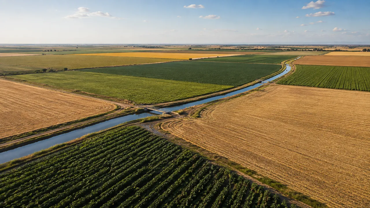
Rainfall totals, crop water demand and soil moisture all move within a two-to-five day window. A short-range weather forecast for irrigation lets the irrigation manager see those shifts coming and adjust the schedule before a run happens, rather than discovering a mismatch after the field has already been watered.
Start with the Field's Current Water Balance
A forecast number means nothing without a field baseline. Weather-based irrigation scheduling starts with three known quantities: current soil moisture relative to the root zone's available capacity, how fast the crop is pulling water from that storage, and what the irrigation system can physically deliver in the available time window. The forecast modifies a decision grounded in those measurements – it does not substitute for them.
Combine Soil Moisture, Crop Demand and Irrigation Capacity
Allowable soil water depletion varies considerably by crop. FAO-56 gives a depletion fraction of around 0.30 for tomatoes during fruit development – meaning irrigation should begin once 30% of available water is consumed – while drought-tolerant crops like cotton tolerate depletion up to 0.65. The same 10mm of forecast rain means something different to each of those fields.
Soil type changes what any given rainfall total delivers to the root zone. Sandy loam can reach near field capacity from 10mm of rain; clay holds far more water per unit depth, so the same 10mm moves the needle much less. Irrigation system type introduces a further split: drip targets a narrow soil column around the root zone, meaning surface rain that stops short of root depth may not reach where the crop needs it; sprinkler coverage wets a broader surface profile and captures more of a rain event's timing benefit.
Which Short-Range Forecast Details Affect Irrigation Planning?
A weather forecast for farmers contains dozens of data points. Four of them change the irrigation decision in practice: rainfall probability, expected amount, event timing, and the atmospheric conditions that set how fast the crop is pulling water from the soil.
Rain Probability, Amount and Timing
A 70% probability of rain still means a 30% chance of nothing reaching the field. Treating forecast precipitation as confirmed water is a planning error – one that short irrigation cycles and daily forecast updates can partially correct, but not eliminate. Research published in Frontiers in Agronomy (2024) found that frequent update runs reduce the practical effect of rainfall mis-forecasts on irrigation scheduling decisions.
A convective burst delivering that total in 30 minutes produces substantially more runoff and shallower infiltration than a frontal system spreading the same amount across six hours at moderate intensity. FAO's concept of effective rainfall captures this: intensity, antecedent soil moisture, slope and crop cover together determine how much of a precipitation event reaches the root zone. A shower landing on a field that was irrigated that morning meets soil that is already close to capacity; the same event reaching a field near its depletion limit has far higher practical value. The millimetre forecast figure says nothing about which situation applies.
Temperature, Humidity, Wind and Crop Water Demand
FAO-56, updated in its 2025 revised edition, standardises reference evapotranspiration calculation using the Penman-Monteith method: four inputs – temperature, humidity, wind speed and solar radiation – combine into a daily ET figure. At 35°C with 20% relative humidity and a 4 m/s wind, reference ET reaches 8 to 10mm per day. At 20°C with 70% relative humidity and calm conditions, the same calculation yields 2 to 3mm. A three-day forecast showing a shift from mild to hot and windy tells the irrigation manager that crop water demand is about to roughly triple – before any field sensor confirms it.
Forecast ET estimates support planning, not precise dosing. Crop coefficients, growth stage, canopy cover and local conditions all shift the actual crop ET away from the reference figure. The forecast narrows the uncertainty; field observation closes it.
Turn the Forecast into an Irrigation Decision
The irrigation forecast feeds into one of four actions: proceed with the scheduled run, reduce the volume, delay the timing, or skip the cycle entirely. The field's current condition determines which part of that decision tree applies.
| Field and forecast situation | Possible action | What to verify |
|---|---|---|
| Soil near depletion limit; no rain forecast within 72 hours | Proceed with scheduled irrigation | Confirm soil moisture reading; check system capacity |
| Soil near depletion; 60-80% rain probability, 15mm forecast within 24 hours | Delay 24-48 hours | Monitor next forecast update; read rain gauge after event |
| Soil at moderate deficit; 10mm forecast as high-intensity convective event | Reduce volume; do not skip | Assess soil after rain; check infiltration vs runoff |
| Soil near field capacity; substantial rain forecast; temperatures falling | Skip irrigation cycle | Re-evaluate at next scheduled window |
Decide Whether to Proceed, Reduce, Delay or Skip
A sandy loam field approaching its depletion threshold with no rain in the 72-hour forecast is a straightforward process. The same field with a 70% probability of 20mm tomorrow justifies a 24-hour delay – but not an open-ended one. If the next forecast update drops that probability to 30%, the delay becomes a risk to crop water status. Short irrigation cycles help here: a system that can apply a partial run the following morning loses less to a mis-forecast than one locked into a weekly schedule.
Partial reduction makes sense when the forecast shows moderate rainfall arriving during the current deficit period but the event looks convective and brief. Applying a reduced irrigation volume before the rain maintains a buffer against runoff-dominated delivery, without adding water on top of what a longer frontal event would reliably provide.
Reassess the Field After Forecast Rain
After a forecast rain event, the gauge reading is what the next irrigation decision runs on, not the predicted amount. A 15mm forecast that delivers 5mm on the gauge leaves a soil deficit that may need addressing within 24 to 48 hours. FAO's effective rainfall concept adds a further layer: even a confirmed 15mm gauge total may not fully reach the active root zone if rainfall intensity was high enough to seal the soil surface or generate runoff before infiltration could occur.
Soil moisture sensors placed at root depth give the most direct post-event reading. Where sensors are absent, a probe or hand-feel check at the crop's active root zone before resuming the irrigation schedule reduces the risk of acting on assumed rather than measured infiltration.
Access location-specific short-range forecasts for your fields through MeteoFlow's weather data integration.
Using Forecast Data Across Multiple Fields and Irrigation Systems
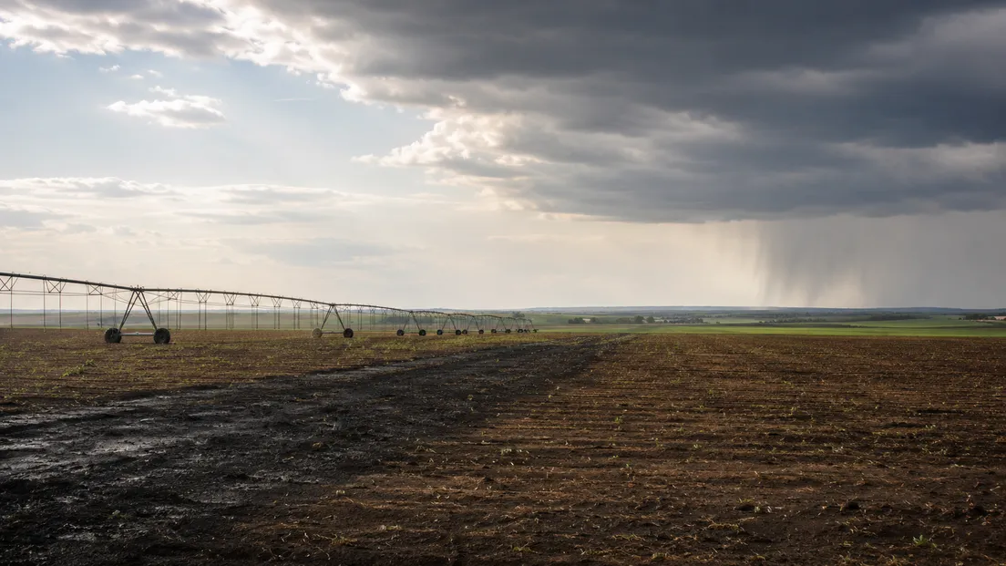
One storm crossing a large farm can drop 15mm at the northern boundary and 3mm at the southern end. A regional forecast averaged across the property assigns both zones the same number. Farms covering several kilometres regularly see rainfall differences of 10 to 20mm from a single convective event, driven by local topography, field elevation and storm cell movement.
A weather forecast API delivers separate rainfall probability, temperature and ET estimates for individual field coordinates rather than one area-wide figure. Irrigation scheduling systems that pull per-field data can apply pre-set rules – soil type, crop, depletion threshold – to flag which zones need to run, which can wait for forecast rain, and which should be reassessed after the event. The farm manager reviewing actual field conditions makes the final call; the location-specific forecast data narrows the options before that review.
Final scheduling decisions stay with the farm manager reviewing current field conditions. Automated recommendations based on forecast data can narrow the decision to two or three options; the agronomic call on which one to act on requires the on-site judgment that no forecast system replaces.
Use MeteoFlow's short-range forecasts to inform daily irrigation decisions across your farm's fields.
FAQ
Are short-range forecasts useful for both drip and sprinkler irrigation?
Sprinkler systems distribute water across the soil surface, so a well-timed rain event can replace a scheduled run when amount and timing align. Drip systems target a narrow soil volume around the root zone; rain that wets the surface but doesn't penetrate to root depth doesn't substitute for the scheduled application. Post-rain measurement at root depth is the more reliable check before skipping a drip cycle than the forecast amount alone.
How often should a farm update its irrigation plan when the forecast changes?
Daily review aligns with typical short-range forecast update cycles and the 1 to 7 day planning horizon most relevant to irrigation scheduling decisions. A significant shift in rain probability – a 70% event dropping to 30% overnight, or a new forecast showing a multi-day heat event – warrants re-evaluating the next scheduled run before it begins rather than waiting for the weekly planning cycle.
Can weather forecasts help farms comply with water-use restrictions?
A forecast showing several high-ET days ahead helps prioritise available allocation toward the most water-critical period. One showing substantial incoming rain may justify deferring a restricted-volume application to a later window when crop demand is higher. Compliance decisions remain with the farm manager and the relevant water authority; forecasts provide the timing information, not the regulatory interpretation.
How can a farm measure whether forecast-based irrigation is saving water?
Seasonal water applied under forecast-based scheduling versus a fixed-schedule baseline for the same crop and soil type gives the most direct comparison. Running that comparison across a full growing season also shows whether the local forecast systematically over- or under-predicts rainfall at the farm's coordinates – a bias worth correcting in future planning. Soil sensor records at root depth before and after each application confirm whether runs matched actual crop water status or got ahead of real demand.


