Types of Clouds: Cloud Names, Formations, and Weather Meaning
Clouds form when moist air cools and tiny droplets or ice crystals gather in the atmosphere. Meteorologists group the types of clouds by height and shape, which makes it easier to tell one pattern from another and understand how the sky is changing.
That is why learning basic cloud types is useful in practice. Certain cloud patterns often appear before rain, stronger wind, or more stable weather. Once you understand the various cloud types and names, it is much easier to correlate what you see overhead with the type of weather that may occur.
What Are the Main Types of Clouds
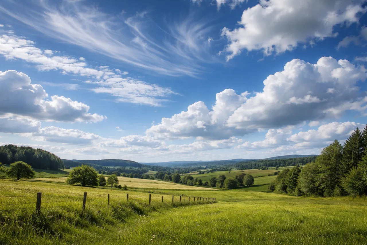
Meteorologists sort cloud types into four broad groups: high-level, mid-level, low-level, and clouds with vertical development. This system is based mainly on altitude and appearance. In practice, it helps observers read the sky more clearly. Some clouds sit high and thin across the upper atmosphere, while others spread low as a gray layer or build upward into tall towers.
Within these groups, the names of clouds describe how they look and how they are structured. Cirrus clouds appear thin and wispy. Altostratus usually forms a broad sheet. Stratus tends to cover the sky in a flat layer, while cumulus clouds look more rounded and piled up. The naming system is simple once you connect each group with its height and visible shape.
High-Level Cloud Types and Names
High clouds form at the greatest heights in the atmosphere, usually above about 6,000 meters. Among the most common cloud names in this group are cirrus, cirrostratus, and cirrocumulus. These clouds develop where the air is very cold, so they form from ice crystals rather than liquid droplets. Because they sit so high, they often look light and delicate from the ground.
Their appearance is one of the easiest ways to recognize them. Cirrus clouds often stretch across the sky in thin, feather-like streaks. Cirrostratus forms a pale veil, while cirrocumulus appears in small rippled patches. High clouds do not usually bring immediate rain, but they often show up before a weather system begins to change.
Mid-Level Cloud Formations
If you look up and see the sky filled with soft patches or wide gray layers somewhere between the high wisps of cirrus and the low overcast, you are probably seeing mid-level cloud formations. These clouds occupy the middle zone of the atmosphere and are most commonly known as altostratus and altocumulus.
Altocumulus often appears as clusters of spherical patches arranged in rows or ripples over the sky. Altostratus has distinct behavior. It often produces a more consistent layer, attenuating sunlight and imparting a pale gray hue to the sky. When these cloud formations start to develop or thicken during the day, it often indicates an increase in atmospheric humidity and a potential shift in weather conditions.
Low-Level Cloud Types and Their Features
Low clouds are usually the ones people recognize first when looking at the sky during ordinary weather. Among the different types of clouds, this group includes stratus, stratocumulus, and nimbostratus. They form relatively close to the ground, typically below about two kilometers, where moist air gathers and spreads out across the lower atmosphere. Instead of isolated shapes, these clouds often stretch across large areas of the sky.
Their presence is commonly linked with dull, damp conditions. A layer of stratus can make the sky look uniformly gray and sometimes brings mist or light drizzle. Stratocumulus clouds appear more uneven, forming rounded blocks that still leave the sky mostly covered. Nimbostratus tends to be thicker and darker, and it is the cloud most often responsible for steady rain that can last for hours.
Vertical Cloud Formations and Storm Clouds

Not all clouds spread sideways across the sky. Some begin small and then build upward, rising layer by layer through the atmosphere. Cumulus clouds are a common starting point. On a warm day they may appear as scattered white towers, but under unstable conditions they can grow quickly into the large storm clouds known as cumulonimbus.
The change becomes visible as the cloud starts to climb higher. Warm air from the surface keeps feeding the cloud from below, and the structure stretches vertically instead of flattening out. A mature cumulonimbus can reach great height and often develops a broad anvil-shaped top that spreads downwind. When this stage is reached, the cloud may produce heavy rain, lightning, thunder, and sudden gusty winds.
You can check current cloud cover and weather conditions for your location on MeteoFlow.
How Cloud Types Help Predict Weather
Different cloud formations often appear in recognizable patterns before the weather changes. Observers have long noticed that certain clouds tend to arrive before rain, wind, or storms. By watching the sky over time, it becomes easier to connect cloud patterns with what usually follows.
For example, thin cirrus clouds sometimes appear a day or two before a weather system moves in. A spreading layer of altostratus may signal that rain is getting closer. Towering cumulonimbus clouds usually indicate strong instability and possible thunderstorms. Experienced observers often look at these patterns to estimate how conditions may develop during the next several hours.
Explore detailed forecasts and real-time weather data for your location on MeteoFlow.
FAQ
How many different types of clouds are officially recognized?
Meteorologists generally classify the sky using 10 main types of clouds. These groups include familiar formations such as cirrus, stratus, cumulus, and cumulonimbus. The system is based on two simple factors: the height of the cloud in the atmosphere and its visible shape. Using these shared categories allows observers and weather specialists to describe the sky in the same way and track how different types of clouds appear as weather conditions evolve.
What cloud types usually bring steady rain?
Steady rain is most often linked with specific cloud types, particularly nimbostratus. This cloud forms a dense, layered blanket that can stretch across large areas of the sky. It usually blocks direct sunlight and produces long periods of light or moderate rain. Unlike tall storm clouds that bring brief downpours, nimbostratus tends to deliver more persistent precipitation.
Can cloud formations change during the day?
Indeed, cloud shapes may change very swiftly. The environment is always changing, and even little fluctuations in temperature, wind, or humidity may alter cloud formations. A morning sky that is initially bright may gradually become overcast as warm air ascends and moisture accumulates in the upper atmosphere.
What are the differences between cumulus and cumulonimbus clouds?
These cloud names signify two phases of cloud development. Cumulus clouds are typically moderate in size, with rounded tops and generally flat bottoms, and they often manifest under steady meteorological conditions. Cumulonimbus clouds form when ascending air persists in rising, resulting in a much higher formation. At that juncture, the cloud becomes linked to thunderstorms, intense precipitation, and lightning.
Why are storm clouds darker than other cloud types?
The reason storm clouds look darker is mostly physical. These clouds are thicker and contain more water droplets and ice particles than lighter clouds. Because the cloud layer is so dense, much less sunlight passes through it. From the ground, the underside then appears deep gray or even nearly black when the cloud becomes especially large and dense.