What Is Dew Point and Why Does It Matter
Dew forms on grass before sunrise. Fog settles in valleys overnight. Both happen for the same reason – the air cooled to a specific temperature and could no longer hold its moisture. That temperature is the dew point. But what is dew point in forecast terms? It is a direct measure of how much water vapour the air actually contains – and the dew point meaning becomes practical the moment conditions approach that threshold.
Dew Point Meaning and Definition
Dew point definition describes a threshold rather than a current condition. It is the temperature the air would need to cool to before condensation begins – and it stays constant as long as the moisture content of the air does not change.
What Dew Point Temperature Means
Dew point temperature meaning in practical terms is a direct measure of atmospheric moisture. A dew point of 10°C means the air would need to cool to 10°C before water vapour starts condensing. A dew point of 22°C means far more moisture is present – and the air is already close to saturation at typical summer temperatures.
The higher the dew point, the more moisture is in the air. That relationship holds regardless of the actual air temperature, which is why dew point is a more reliable indicator of atmospheric moisture content than relative humidity alone.
Why Moisture Condenses in the Air
Air has a maximum capacity for water vapour that decreases as temperature falls. When air cools to its dew point, that capacity drops to match the actual moisture present – and any further cooling forces water vapour into liquid droplets.
This is why dew forms on grass overnight. The surface cools faster than the air above it. When the grass temperature drops to the dew point of the surrounding air, condensation begins on contact. The same process produces fog when a layer of air near the ground cools to its dew point across a wider area.
Dew Point and Humidity Explained
Dew point and humidity measure related but distinct things. Relative humidity is a percentage – it shows how close current air moisture is to the maximum the air can hold at its current temperature. Dew point is an absolute value – it reflects actual moisture content without reference to temperature capacity.
The practical difference matters most when temperatures change. On a warm afternoon, relative humidity may drop to 40% while the dew point stays constant at 15°C. As the evening cools and air temperature approaches the dew point, relative humidity rises toward 100% – even though no new moisture has entered the air. Dew point stayed fixed; relative humidity changed because the air's capacity changed.
For understanding how the air actually feels and how close conditions are to fog or dew formation, dew point gives a more stable and directly useful reading than relative humidity alone.
How Dew Point Temperature Affects Comfort
Dew point temperature is the most reliable indicator of how humid air actually feels on the body. Relative humidity changes throughout the day as temperature rises and falls – dew point stays constant unless the moisture content of the air changes. That stability makes it a better guide for comfort than the humidity percentage shown in most forecasts.
A dew point below 10°C feels dry and comfortable in most conditions. Between 13°C and 16°C, the air starts to feel slightly humid but remains tolerable. Above 18°C, most people notice the heaviness – sweat evaporates more slowly, physical exertion feels harder, and prolonged outdoor activity becomes less comfortable. Above 21°C, conditions feel oppressive for the majority of people regardless of air temperature.
This scale is consistent because dew point directly reflects how much moisture the air can still absorb from the skin. High dew point means the air is already close to saturation – it has limited capacity to take on more moisture through evaporation, which is the body's primary cooling mechanism.
Check dew point values alongside humidity on MeteoFlow to better understand how the weather will actually feel outside before you step out.
How Meteorologists Measure Dew Point
Dew point is measured using an instrument called a hygrometer, or derived from temperature and relative humidity readings taken at weather stations. The most precise method uses a chilled mirror hygrometer – a polished surface is cooled until condensation forms on it, and the temperature at that moment is the dew point.
Modern weather stations typically calculate dew point automatically from temperature and humidity sensor data. The calculation is well established and produces consistent results across different instrument types. Radiosondes – the instrument packages carried by weather balloons – measure dew point at multiple altitudes as they ascend, giving meteorologists a vertical profile of atmospheric moisture that surface readings alone cannot provide.
That vertical data matters for forecasting. A layer of dry air above a moist surface layer can prevent convection from developing into storms. A moist layer at mid-levels can sustain precipitation once it starts. Dew point at altitude is as relevant to forecast accuracy as the surface reading most people see in a weather app.
Why Dew Point Matters in Weather Forecasts

The meaning of dew point in a forecast context goes beyond comfort. Dew point values drive decisions about fog probability, precipitation type, storm development, and air quality – making it one of the most practically significant numbers in any detailed weather product.
Fog, Rain, and Condensation
Fog forms when surface air cools to its dew point overnight or in conditions of low wind and high moisture. A forecast dew point close to the overnight low temperature is a reliable fog indicator – the smaller the gap between them, the higher the probability that condensation will reach ground level.
Precipitation likelihood also connects directly to dew point. High surface dew points indicate abundant low-level moisture available to feed developing clouds. When that moisture is lifted – by a front, terrain, or convective heating – it condenses rapidly and produces significant rainfall. Forecasters use dew point as a proxy for the moisture fuel available to a storm system before it develops.
Heat, Storms, and Air Quality
High dew points combined with high temperatures create conditions where thunderstorm development becomes more likely. Warm, moist air is less stable than dry air at the same temperature – it rises more readily when disturbed, and the moisture it carries releases latent heat as it condenses, accelerating the updraft further.
Air quality also responds to a dew point. High atmospheric moisture increases the concentration of particulates and pollutants near the surface by suppressing vertical mixing. On high dew point days, haze and poor air quality often accompany the physical discomfort – the two effects share the same atmospheric cause.
Use MeteoFlow to track dew point, humidity, and changing weather conditions for your exact location – before conditions shift.
FAQ
What is considered a comfortable dew point?
A dew point below 10°C feels dry and comfortable for most people. Between 13°C and 16°C the air feels mildly humid but tolerable. Above 18°C most people notice discomfort, and above 21°C conditions feel oppressive regardless of air temperature.
Why does high dew point make weather feel hotter?
High dew point means the air already holds significant moisture and has limited capacity to absorb more through evaporation. Sweat evaporates more slowly, reducing the body's ability to cool itself. The result is that heat feels more intense than the thermometer reading alone would suggest.
Can dew point be higher than air temperature?
No. Dew point cannot exceed the actual air temperature. When the two values are equal, relative humidity is 100% and the air is fully saturated. Any further cooling at that point produces condensation rather than allowing dew point to rise above the air temperature.
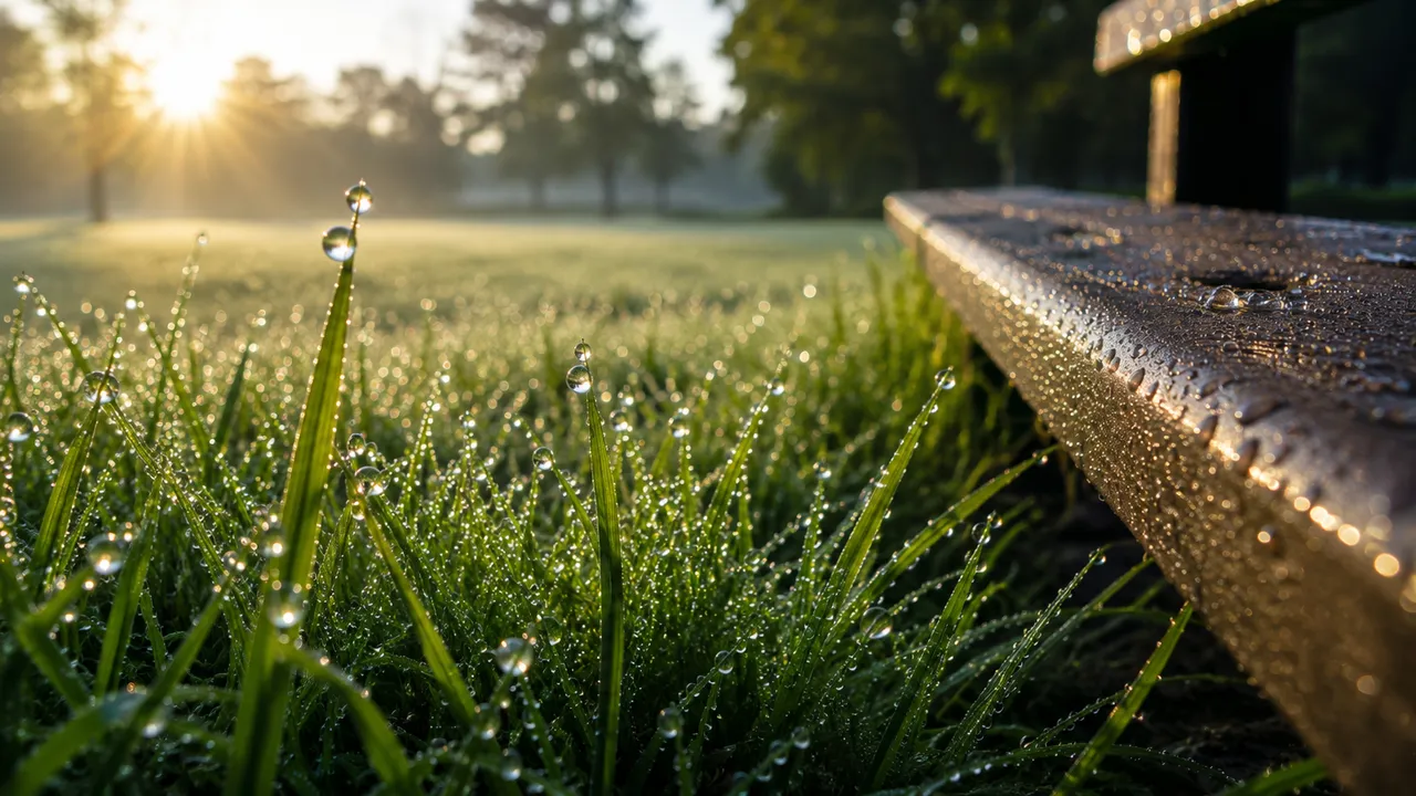
Why does dew form on grass and windows?
Grass and window surfaces cool faster than the surrounding air overnight. When their surface temperature drops to the dew point of the air in contact with them, water vapour condenses directly onto those surfaces. The air temperature may still be above the dew point while condensation forms on cooler objects nearby.
Does dew point change during the day?
Dew point stays relatively stable unless the actual moisture content of the air changes – through advection of a different air mass, evaporation from rain, or transpiration from vegetation. Unlike relative humidity, which rises and falls with temperature throughout the day, dew point remains a consistent measure of how much moisture the air actually contains.